


vmm 2036C Escarcets

jmheydorff
User

Length
15.7 km

Max alt
297 m

Uphill gradient
295 m
Km-Effort
19.7 km

Min alt
71 m

Downhill gradient
298 m
Boucle
Yes
Creation date :
2023-04-07 07:48:22.37
Updated on :
2023-04-09 18:35:45.22
4h28
Difficulty : Very difficult

FREE GPS app for hiking
 SityTrail
IGN / Geographical institutes
SityTrail Plus
The world is yours!
About
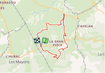
Trail Walking of 15.7 km to be discovered at Provence-Alpes-Côte d'Azur, Var, Le Cannet-des-Maures. This trail is proposed by jmheydorff.
Positioning
Country:
France
Region :
Provence-Alpes-Côte d'Azur
Department/Province :
Var
Municipality :
Le Cannet-des-Maures
Location:
Unknown
Start:(Dec)
Start:(UTM)
287996 ; 4800300 (32T) N.
Comments